interview with Benjamin Dewals
Bridging science and policy
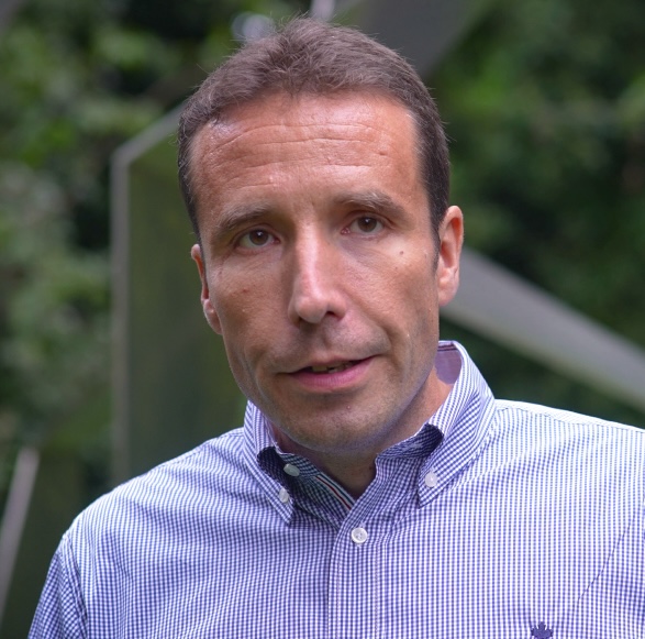
Prof. Benjamin Dewals, Professor of Water Engineering at the University of Liège
Benjamin Dewals
Prof. Benjamin Dewals researches fluvial hydrodynamics and hydrological risk management. He is one of the leaders of the Hydraulics in Environmental & Civil Engineering (HECE) research group at the University of Liège. The group specialises in hydrological and hydrodynamic modelling. It develops the academic computational model WOLF and operates a hydraulic laboratory. Prof. Dewals has led several regional, national, and European research projects in the fields of urban flood risk modelling, dike breaching, climate adaptation and resilience, and the application of nature-based solutions to mitigate riverine and pluvial floods.
Welcome Benjamin, thank you for making the time to talk to us. Could you tell the readers a bit about yourself and what the role of your institute is?
"We are a group of researchers specialized in hydrological and hydrodynamic modelling. On one hand, we develop computational fluid dynamic models to simulate hydrological processes, as well as hydrodynamics in riverbeds and floodplains. On the other hand, we operate a large hydraulic laboratory where we conduct physical experiments.
Our in-house modelling system has been developed over the past 20 years. It covers everything from rainfall to hydrological flow in the catchment, river flow, hydraulic structures, overflow, and floodplain flow between buildings. We are also developing damage modelling components. These models are used for research and to advise stakeholders and policymakers.
In addition to the modelling, we have a 1000-square-meter hydraulic lab that helps us better understand complex processes like turbulence and transport that are difficult to model computationally. For instance, in connection with JCAR ATRACE, we have conducted experiments on the effect of floating debris clogging bridges during extreme floods. Small-scale models of bridges were created in the lab, and batches of reduced-scale floating debris, mimicking tree logs or containers, were dropped into the water. A detailed monitoring system recorded the debris' impact on bridges and its effect on water flow. This research, initiated under other European projects, will continue under JCAR ATRACE.
For the past 10 years, we’ve also organized the annual International Meuse Symposium, co-hosted with Deltares. This symposium brings together about 100 participants from academia, water management organisations, and industry to discuss topics like hydrological and hydrodynamic modelling, water management, and environmental impacts related to the Meuse basin. It aligns well with JCAR ATRACE’s objectives of strengthening cooperation between countries and regions, such as Wallonia, the Netherlands, and parts of Germany."
Your institute has contributed significantly to research following the July 2021 floods in Wallonia. Could you tell us what research has been conducted and how it addresses urgent policy questions?
"Certainly. There are three main aspects:
First, we worked on the computational model I mentioned earlier, WOLF (which stands for ‘FLOW’ reversed). After the 2021 floods, we updated the model with the latest topographic data. Erosion and other dynamic effects had changed the bathymetry of rivers and floodplains, so we used new surveys to incorporate these changes. The model, which was previously used mostly for research, is now fully operational and being used by engineering firms to design risk reduction measures for the affected valleys.
We have also recoded the model to run on a GPU system, speeding up computations significantly. Along with this, we have created extensive documentation to support its use in policy and stakeholder decision-making on risk reduction.
The second aspect is the field survey we initiated after the floods. We collected data from about 420 households on damage costs, monetary losses, and the compensations they received. We also gathered variables that help us understand the damage mechanisms, such as the structure and materials of the buildings, the water depth during the flood, and the flow velocity. These variables, combined with information on whether households received warnings or took preventive measures, provide valuable insights that public authorities and insurance companies usually do not collect.
The third aspect involves the impact of floating debris. We conducted field observations and analysed hundreds of photos to document how debris affected bridges. This resulted in an open database, available online , which can be used for further analysis. We also conducted laboratory experiments on floating debris, as mentioned earlier, which will continue under JCAR ATRACE."
We see that the weather is becoming more unpredictable, with longer droughts in recent years and now a very wet 2024. How does your research institute work with local administration, in this case Service public de Wallonie (SPW) to ensure the region is prepared for these challenging circumstances?
"In several recent research projects, SPW is part of the consortium or acts as an associated partner. SPW brings to the research projects insights from its field experience, such as operational flood risk management, as well as valuable data. The research outcomes often provide recommendations for the design and stress testing of risk reduction measures, which in turn support improved flood risk management by SPW. Representatives of SPW, such as Ms Heindrichs, actively contributed to the JCAR ATRACE launch event last November in Maastricht."
What do you think are the most pressing challenges for water managers in smaller transboundary river basins in Wallonia?
“One key challenge is to strengthen the chain from precipitation forecast to flood impact forecast. While rain and hydrological forecasts are common, predicting flood impacts is crucial for disaster management. Knowing the discharge in cubic meters per second is not enough—water managers need to know which streets will be flooded, the water depth, and the range of flow velocity. This information helps emergency services decide whether they can reach certain areas and whether people need to evacuate.
In 2021, this level of detail was not available, making it difficult to make critical decisions. Improving flood impact forecasting systems will greatly enhance disaster management and reduce the impact of future floods.”
Could you reflect on how water management in Wallonia is organised?
“I am a scientist, working on modelling, but in general, I would say that improving
the risk culture is crucial. For example, better communication with the population could make more people, including local authorities and stakeholders, aware of risks. This can save lives, as it is well known that when people are risk-aware, they tend to take responsibility, implementing mitigation or protection measures themselves. This awareness reduces both damages and risks to life.
A concrete example is from some of our studies, where we showed how the flood extent in 2021 far exceeded what was mapped in official flood hazard maps. Buildings were flooded with two meters of water, yet these areas were marked as outside the flood hazard zone. This is being addressed in Wallonia, as updated flood hazard maps will now include more extreme scenarios that were previously excluded. These extreme scenarios, with a low probability of occurrence (one in 1000 years, for example), will show a broader flooded area on the map. This does not mean building there should be restricted, but people should be aware of the risk. This awareness contributes to a better risk culture and reflects the positive direction Wallonia is taking in these decisions.”
What lessons from your research on the 2021 floods can be further elaborated on in JCAR ATRACE for transboundary river basins?
"For the first time, we conducted surveys to collect information on flood damage and explanatory variables in Belgium. Now, within JCAR ATRACE, we are comparing this data with similar data from Germany and the Netherlands. As far as I know, this is the first time such a comparison is being made across these three countries. It will reveal whether flood damage mechanisms differ by country, and we expect some differences due to variations in flood intensity.
For example, in Germany, floods were more extreme in some regions compared to others, while in Valkenburg, the Netherlands, the flood was less severe. Depending on the severity of the flood, the key variables for predicting flood damage will vary. This kind of research is only possible in a program like JCAR ATRACE, which facilitates international collaboration.
Another lesson from our previous research is the critical importance of sharing data. Data must be collected and structured in compatible formats, which takes time. For instance, flood survey data was collected differently across regions, so making it compatible adds significant value, enabling lessons to be learned across countries."
What topics are of interest for your institute to work on together with partner institutes within the JCAR program?
"There are several topics. First, the effect of floating debris on bridges is something my colleague Dr Sébastien Erpicum will work on with TU Delft and RWTH Aachen. We will also continue with damage modelling and estimating flood losses, collaborating with the VU Amsterdam, the GFZ Research Centre in Potsdam, and the University of Potsdam. This will be the focus of a PhD thesis funded by JCAR at the University of Liège, with a transnational perspective, as past studies have been limited to individual countries. We also aim to extend our analyses beyond residential buildings to include business sectors.
Another long-term focus is on nature-based solutions, which aim to give more room to rivers and slow down water flow. These solutions are attractive because they tend to be more robust during extreme events, whereas grey solutions, like concrete walls or dikes, may fail under extreme conditions.
However, there are still scientific questions about how to implement nature-based solutions in hydrodynamic models and how to assess their performance compared to grey solutions. Another long-term topic of interest is pollutant transport during floods, which is rarely addressed in current models but is crucial due to its severe consequences."
What is the added value of JCAR ATRACE in strengthening adaptation and resilience in transboundary river basins in the Benelux and neighbouring countries?
"Several expert commissions and parliamentary hearings after the 2021 floods rightly recommended more cross-border collaboration, as water does not stop at borders. JCAR ATRACE accelerates this cross-border cooperation between regions, making a real difference in addressing these challenges. Traditionally, the process of fostering cooperation across borders was slow, relying heavily on occasional meetings or projects. JCAR ATRACE, however, speeds this up by providing a structured platform for continuous collaboration.
In addition to this, JCAR ATRACE also focuses on mentoring, training, and capacity-building. These efforts ensure that water managers and stakeholders are better equipped to handle the timely and pressing questions surrounding flood management and disaster preparedness.
Much like the International Meuse Symposium, which we organise annually to bring together stakeholders from academia and water management organisations, JCAR ATRACE fosters similar cooperation. However, while the Meuse Symposium happens only once a year, JCAR ATRACE allows experts to work together year-round, ensuring that this collaboration remains dynamic and responsive to emerging challenges throughout the year. This ongoing cooperation strengthens adaptation and resilience in the region’s transboundary river basins."
