Interview
Connecting environmental insights and transboundary collaboration
In our conversation with Laurent Pfister from the Luxembourg Institute of Science and Technology, we delve into the evolution of flood monitoring systems and explore the critical role of both local and international cooperation.
Dr Laurent Pfister
Hydrologist at the Luxembourg Institute of Science and Technology (LIST)
Laurent Pfister is a hydrologist at the Luxembourg Institute of Science and Technology (LIST), where he leads the Environmental Sensing and Modelling research unit. He is also an Affiliated Professor in Environmental Sciences at the University of Luxembourg. His research is focusing on the holistic understanding - via interdisciplinary approaches - of intrinsically coupled hydrological and human systems in a context of global change and subsequent non-stationarity of environmental systems. Since 2000, he has coordinated nearly 50 applied and fundamental research projects - several introducing innovative technologies for overcoming limitations in water resources research and management (e.g., cell phone microwave links for measuring rainfall, portable mass spectrometer for high-frequency analysis of O and H isotopes in water, terrestrial diatoms as hydrological tracers, and more recently freshwater bivalves for reconstructing d18O signatures in stream water).
Welcome Laurent, thank you for your time. Could you tell the readers a bit about yourself and what the role of your institute is?
Certainly! I am a hydrologist by training, and I completed my PhD at the University of Strasbourg in France back in 2000. My doctoral research was conducted in collaboration with a Research Institute in Luxembourg, which merged in 2015 to form the Luxembourg Institute of Science and Technology I work for today. I joined this organisation immediately after finishing my PhD.
Our institute is classified as a Research and Technology Organisation (RTO). We engage in a diverse range of activities that span the entire spectrum of the technology readiness level (TRL) scale, from fundamental research to applied solutions. Within our institution, we have various research units dedicated to key areas such as artificial intelligence, environmental issues, material sciences and space resources.
In my role, I specifically work within the environmental domain, concentrating on issues related to water - this includes both water quantity and quality, as well as the impacts of climate change and global change on natural resources.
In 2021, Luxembourg experienced significant flooding that led to numerous evacuations. How has this flood event influenced your research priorities and the focus of your institute?
While the 2021 flood event was certainly impactful, I would not say it altered our research priorities. Our focus on hydrology and climate change has deep roots that extend well before this event. For instance, we witnessed major floods in Luxembourg and across the broader region in 1993 and 1995. During that time, the absence of a modern forecasting system, connected in real time to meteorological stations, and stream gauges made the situation quite different from today.
In response to the flooding in 1993, the government decided to invest heavily in a modern hydrometeorological monitoring network along with a flood forecasting system. Recognising this gap, we saw an opportunity to deepen our research into the processes that govern rainfall-runoff transformation - mainly, but not exclusively, in headwaters. We have since aimed to integrate this understanding into routine monitoring and forecasting activities. Thus, our fundamental focus on the hydrological processes has remained largely consistent, irrespective of the 2021 event.
However, it is essential to note that since 2016, we have encountered increasingly catastrophic flash floods - events that posed much more significant challenges than we had been prepared for. Our existing monitoring protocols and forecasting systems were not equipped to handle the highly localized and intense nature of flash floods. This realisation prompted us to adapt our systems so we can better manage such extreme events, which are often associated with Mediterranean regions.
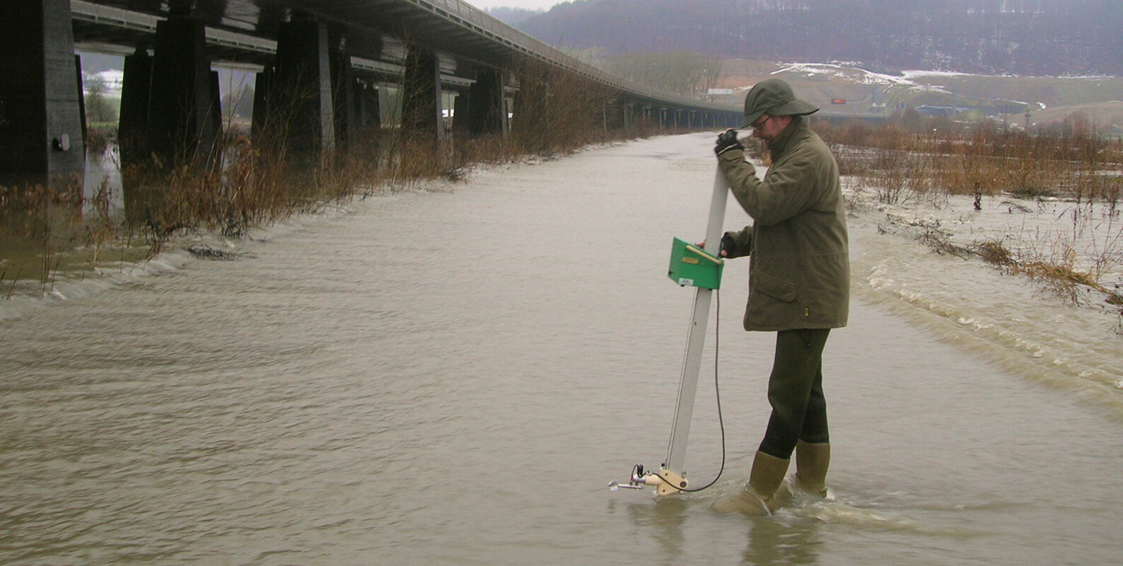
In-situ flow measurements during a flood event.
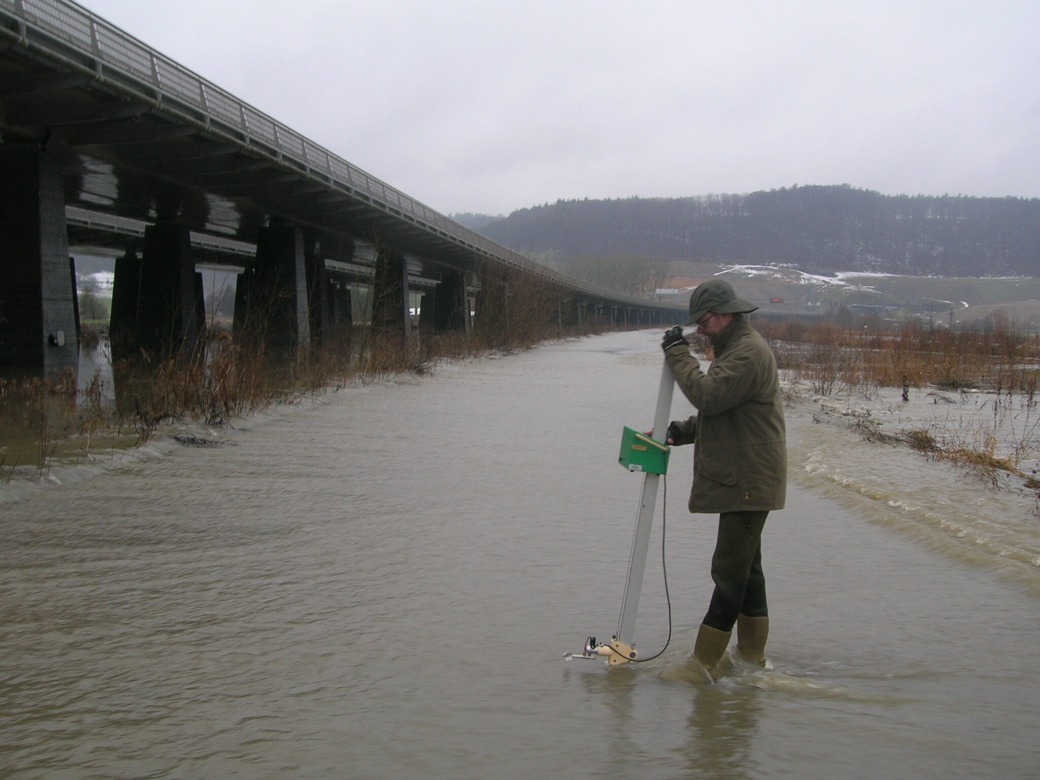
In-situ flow measurements during a flood event.
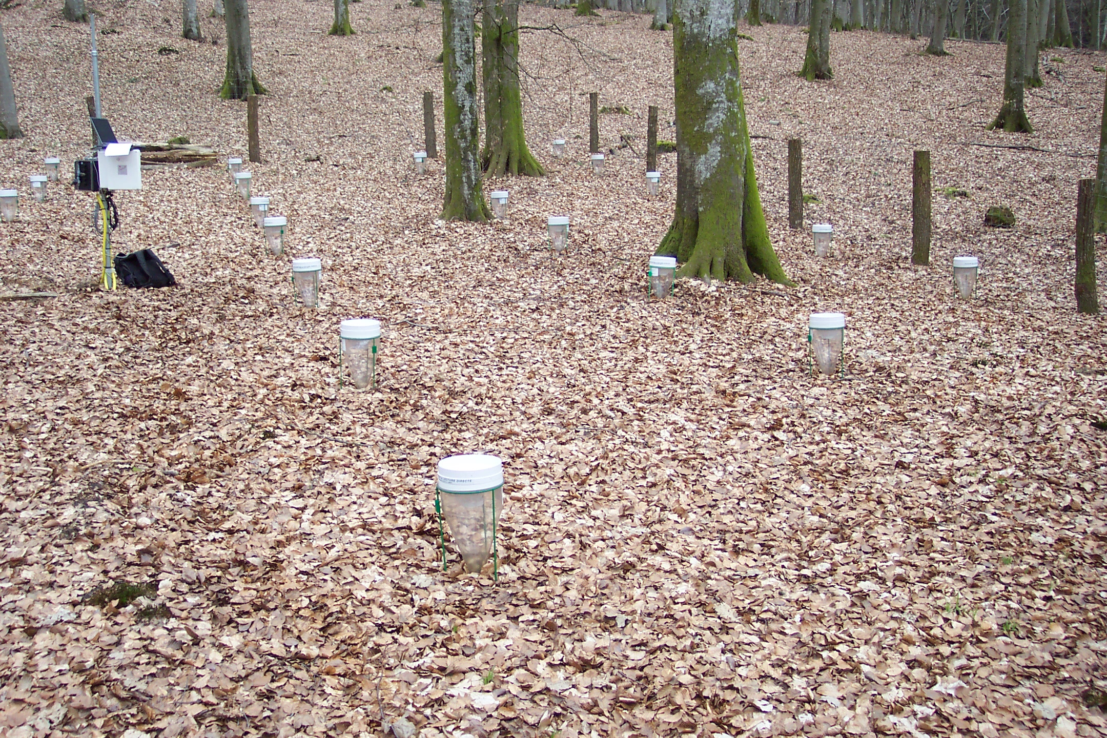
Experimental setup measuring rainfall throughfall in a forest.
We would like to dig deeper into the topic of the unpredictability of weather patterns. With longer droughts and extreme rainfall, as mentioned before, how does your research institute collaborate with local administrations - specifically, the Administration de la gestion de l’eau (Water Management Authority) - to address these challenges?
Our collaboration with local authorities has been ongoing for almost three decades. From the very beginning, we have worked closely with them to address water management challenges. Local authorities typically focus their monitoring efforts on larger rivers, as their floodplains typically host villages, towns, and industrial regions. In contrast, our emphasis is more on the headwaters, although we do not limit ourselves to just that.
Our objective is to cover a wide array of geological settings, soil types, and land use classifications, which ultimately proves invaluable to local authorities. It provides them with deeper insights into the processes that dominate rainfall-runoff response and the factors that may lead to delays in runoff.
The monitoring networks we operate - both ours and theirs - are complementary. We have always ensured mutual awareness of our respective areas of operation. By sharing our datasets, we enable them to access our data while we can utilise theirs as needed.
Beyond data sharing, we also engage in collaborative projects, primarily those that have a practical orientation and are often funded by local authorities. For instance, following the 2021 flood, we conducted an in-depth analysis of the event. This involved investigating various factors, including the meteorological conditions and the response of different catchments based on their geology and land use. This kind of analysis is standard practice for us after any extreme event.
In recent years, we have established a routine of holding regular meetings with local authorities to keep them informed about our fundamental research. These meetings also provide an opportunity for them to communicate their priorities and specific areas they would like us to focus on in our research projects. While it does not guarantee funding for these projects, it gives us valuable insights into their needs. Consequently, when we submit proposals to national funding agencies or European Union programs, we can align our research goals with their priorities at both national and international levels.
One notable example of our collaboration is a project we executed in partnership with the National Telecom Company and the City of Luxembourg. The initiative aimed to utilise microwave links for measuring rainfall over long distances. The technology relies on antennas used for mobile telecommunications, which transmit microwave signals. When it rains, the signals weaken, and this attenuation can be translated into precise precipitation measurements, particularly valuable for intense rainfall events. Relying solely on rain gauges can sometimes be less effective.
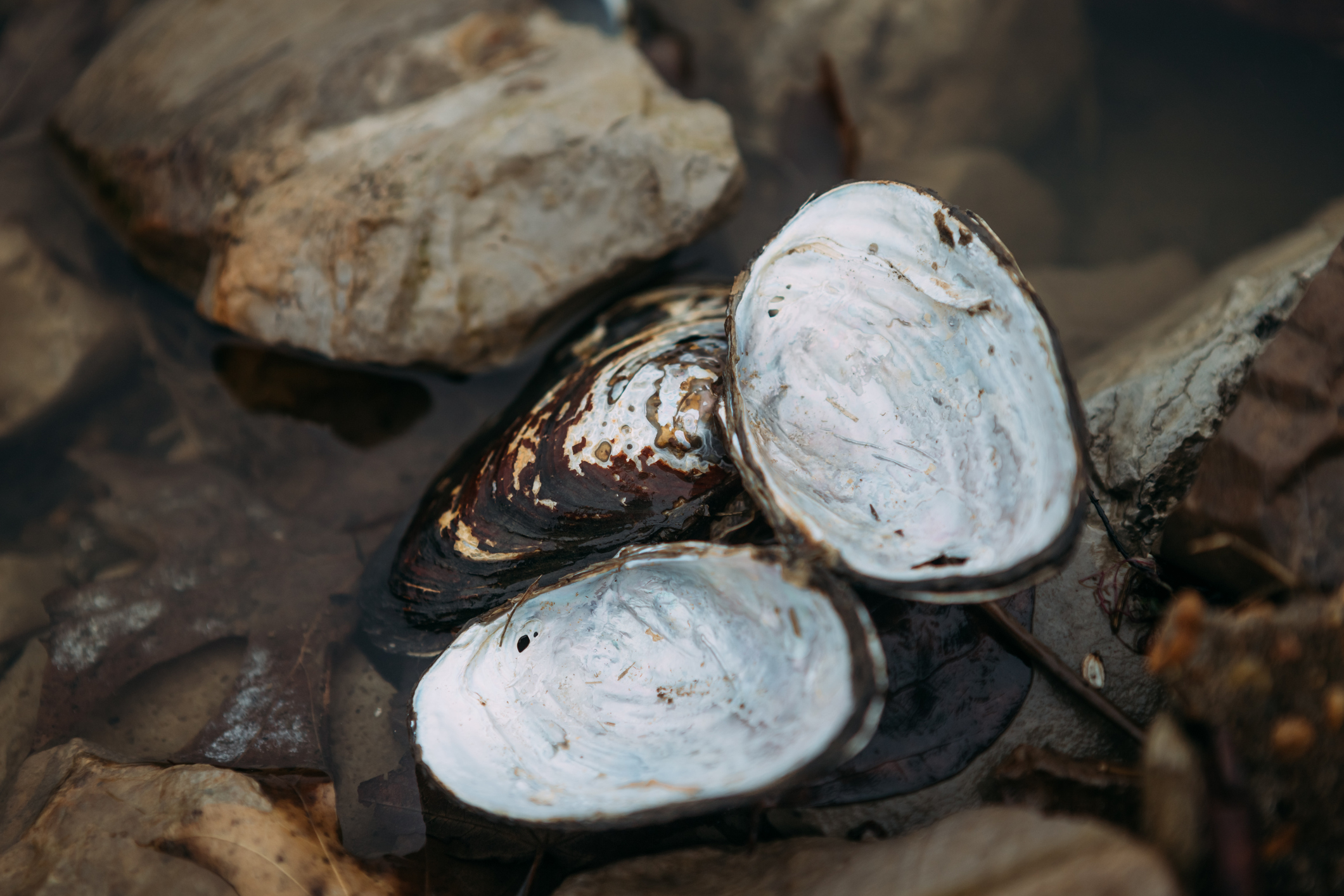
There is a growing consensus that climate change is a reality. While we have access to 30 years of high-resolution data on rainfall and stream flow, this data is limited for periods further back in time. To overcome this limitation, we utilise natural proxies such as tree rings and freshwater mussels, which can live for up to 200 years. These natural recorders allow us to reconstruct historical environmental conditions, including meteorological data and river discharge patterns.
Additionally, we employ stable isotopes of oxygen and hydrogen to determine water travel times within a catchment area. This enables us to trace the history of our flowing waters, reaching back 200 years or more, well before the advent of modern measurement instruments. Such historical data is particularly valuable to managers and stakeholders, as it provides insights into how current water behaviour compares to what was considered normal 100 or 200 years ago.


As Luxembourg is situated upstream of other countries involved in the JCAR ATRACE project, how do you think this geographical position shapes your institute’s approach to international water management, particularly in terms of flood and drought forecasting?
Luxembourg has had a unique position in international collaborations over the past 30 years. The JCAR ATRACE project is not our first involvement in international efforts, and being part of these projects is very much also related our distinctive monitoring network.
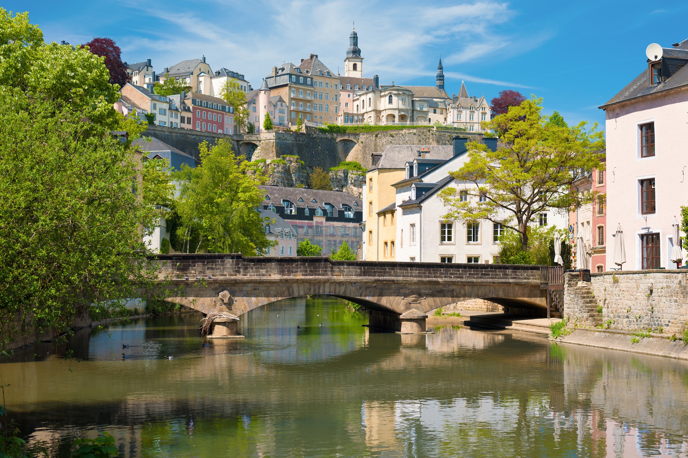
Although Luxembourg is small, it features a diverse physiography. Some areas are part of the schistous Ardennes, while others belong to the Gutland region, characterised by different landscapes, including sandstone and marl. However, the climate is generally consistent across the country, making it an ideal open-air laboratory for environmental research.
When speaking with people from countries like the Netherlands, Germany, or Belgium, it is evident that the floods they experience are often much larger than those in Luxembourg due to their larger floodplains and greater water volumes that have to be dealt with. Nonetheless, our dense monitoring network and varied physiographic environment provide significant value in these international collaborations - notably since the vast majority of floods take their origin in headwaters.
To stay on this topic of borders, as you mentioned neighbouring countries like Belgium, Germany, and others, how does this transboundary context influence your water management strategies and initiatives?
When it comes to water management strategies, the person best placed to answer this question would certainly be Mark Hans, the director of the Water Agency. But I can still share some thoughts.
Since we are positioned in the headwaters, almost the entire country contributes to the larger river basins. Every measure we take here in Luxembourg will certainly have consequences downstream. If, for example, we take measures to slow down the progression of flood waves, or conversely, if we try to get rid of water as quickly as possible, it will affect those living further downstream. In an immediate sense, this would impact areas in Germany, because most of the water drained in Luxembourg eventually ends up in the Moselle River and then flows into the Rhine. The first ones to be impacted are the people living downstream of Luxembourg.
Being part of projects like this one raises awareness about this shared responsibility. From a research perspective, we do not want our findings or the application of our research to be limited to a small geographic area. By collaborating with colleagues from Belgium, France, Germany, and the Netherlands, we can compare our findings, benchmark them, and use them to draw conclusions in a broader context. The opportunities for applying our research - whether applied or fundamental - are much greater when we are part of such international collaborations.

Once you are part of the network, you get a different perspective. It is important to understand that the decisions made in headwater areas, like ours, have consequences for people downstream. This is where I see the added value of projects like JCAR ATRACE.
Dr Laurent Pfister
Hydrologist at the Luxembourg Institute of Science and Technology (LIST)
JCAR ATRACE is a great platform for exchanging knowledge and experiences. Living in a headwater catchment, we observe how our creeks and rivers respond quickly to changes, but this is very different from what people might experience in the lower parts of the river system, like in the Netherlands. However, everything is connected. What happens in the headwaters eventually impacts downstream areas, and this interconnectedness is sometimes overlooked if you are only working within your own area of interest.
Once you are part of the network, you get a different perspective. It is important to understand that the decisions made in headwater areas, like ours, have consequences for people downstream. This is where I see the added value of projects like JCAR ATRACE, especially for us, coming from a small country mostly constituted of headwaters of the River Rhine basin. The diversity of our physiographic characteristics, combined with a relatively homogeneous climate, offers a lot of value when it comes to defining adaptation and mitigation strategies.
It is always essential to ensure that the outcomes of your research are not confined to a small circle of stakeholders. However, it is not a trivial task. The processes we are dealing with in the headwaters are much faster, sometimes happening in just half an hour or a few hours, while in larger rivers, like the Moselle or Rhine, the dynamics are different and often delayed.

Experimental setup measuring rainfall throughfall in a forest.
If we get this right, it is about understanding your own geographical context - looking upstream and downstream, and thinking beyond borders, correct?
Yes, exactly. The challenge lies in transposing findings from one area to another. The scales are different, the geology, land use, even the climate can vary. By collaborating with people who are working on similar issues in different settings, you gain a better understanding of the mechanisms that drive these differences and how they influence the rivers' responses to climate change. It is through exchanging knowledge that we can better understand how systems function on larger scales, beyond the areas we are studying on an individual basis.
Dr Laurent Pfister
Hydrologist at the Luxembourg Institute of Science and Technology (LIST)
